
Nepal Floods: Glacial Collapse Triggers Catastrophic Flooding
Nepal floods have killed more than 1,000 people and left thousands more missing after a glacier collapse triggered catastrophic flooding on the Nepal-China border, in what has become Nepal’s deadliest natural disaster in more than a decade.
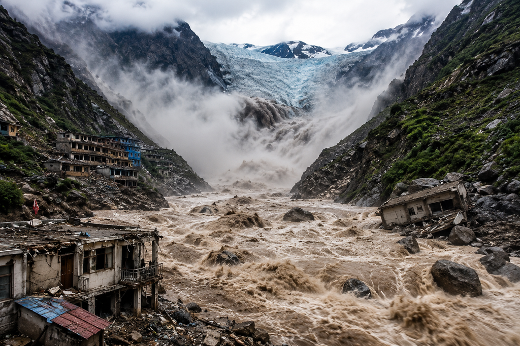
The disaster struck on 26 August, when a huge section of glacier broke away high in the Himalayas and plunged around 7,000ft down the mountainside into a river valley below. Geoscientist Jakob Steiner, of the University of Graz, described the scene in satellite imagery as though someone had sliced a chunk more than a kilometre wide from the base of the glacier and dropped it off the cliff. The mass of ice, rock and sediment fell roughly 1.2km before hitting the valley floor, briefly damming the river and forming a lake.
The impact was powerful enough to register as a magnitude 5.2 seismic event. Nepal’s foreign minister initially said the flood had been triggered by an earthquake-linked avalanche, but the US Geological Survey later said the seismic signal had actually come from the collapse itself, rather than the other way round. Researchers studying the satellite record, including Planet Labs and Landsat imagery, confirmed the sequence: the glacier gave way first, and the tremor was a consequence of that collapse rather than its cause.
Nepal Floods and the Glacial Collapse
Rock, ice and mud crashed into the Lhende Khola river before surging into the Bhote Koshi and, further downstream, the Trishuli River, carrying floodwater south through Nepal. In some places, water levels rose by as much as nine metres in just half an hour, giving residents almost no time to flee before the surge arrived. The barrier lake that briefly formed after the initial collapse has since begun draining on its own, and Chinese officials say the risk of it bursting completely is now low. Even so, they have warned that other nearby glaciers could still collapse, meaning the region remains an active hazard zone more than a week after the initial disaster.
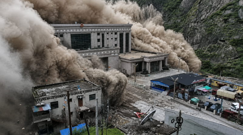
The worst damage was in Nepal’s Rasuwa district, on the border with Tibet, where the towns of Timure and Syapru Besi were largely destroyed. Floodwater then moved downstream into the Nuwakot and Dhading districts, sweeping away homes, roads and bridges as it went. On the Chinese side of the border, mud and debris slammed into the Gyirong Port crossing in the Shigatse region, flattening buildings and infrastructure there. A Chinese rescue team leader described the checkpoint’s structures as having been reduced to rubble, with barely any outline of buildings left standing.
Rasuwa is also home to a number of hydropower construction sites, where crews dig long tunnels into the mountainside to exploit the steep drop between Himalayan rivers and lower-lying power stations. Hundreds of workers were on site along the Bhote Koshi when the flood hit, and many are feared trapped in tunnels that filled rapidly with mud and water. Rescuers say searching those tunnels has been one of the most difficult and dangerous parts of the entire operation, given the risk of further collapse and the thick mud blocking access.
The area was also busy with travellers when the disaster struck, since Rasuwa sits on a route used by pilgrims and tourists crossing between Nepal and Tibet, and the flood hit during a peak season for both. Among those still missing are 77 pilgrims from the Isha Foundation, travelling in a group representing 19 different nationalities, who were at Gyirong Port when the water hit. Other missing travellers and workers come from India, the United States, Ukraine, Malaysia, Australia, the United Kingdom, China, Canada and South Korea, according to figures released by their respective governments. South Korea’s foreign ministry said nine of its citizens working at a hydropower construction site were unaccounted for. For many of the families involved, the wait for news has stretched well beyond the first frantic days of the disaster, with embassies in Kathmandu fielding a steady stream of enquiries from relatives abroad who have had no contact with loved ones since 26 August.
A rising death toll
Nepal’s National Disaster Risk Reduction and Management Authority has revised the death toll several times a day since the disaster struck, as bodies continue to be recovered downstream and rescue teams reach communities that had been completely cut off. As of Wednesday, 2 September, the confirmed death toll in Nepal stands at 1,114, according to the agency’s latest update, while roughly 4,500 people remain unaccounted for across Nepal and China combined. Nearly 12,000 people have been rescued in Nepal so far, and at least 466 people have been injured, most of them being treated in hospitals close to the disaster zone. On the Chinese side of the border, at least 16 people have died and around 546 are missing, including 261 foreigners, according to the most recent figures from state broadcaster CCTV.
It is Nepal’s deadliest natural disaster since the devastating earthquake of April 2015, which killed around 9,000 people and left much of the country’s infrastructure in ruins. It also follows a run of major disasters elsewhere this year, including earthquakes in Colombia and Indonesia, part of what has been a difficult year for natural disasters worldwide.
Landslides have destroyed roads and bridges across Rasuwa, forcing rescue crews to rely heavily on helicopters and drones to reach isolated communities, and poor weather has repeatedly grounded aircraft in the days since the flood. The United Nations says contact still has not been re-established with some of the worst-hit areas, more than a week after the disaster began, meaning the true scale of the losses there is still unknown. Nepal’s Foreign Minister, Shisir Khanal, told CNN this week that the government is “still trying to save lives,” including people believed to remain trapped in flooded hydropower tunnels — a reminder that, more than a week on, this is still an active rescue operation rather than a purely a recovery one.
Warning signs before the collapse
A report released this week found that the glacier had shown visible signs of instability in the days before it gave way, including discoloured, brown meltwater and cracks forming in the surrounding bedrock. The finding is likely to raise difficult questions about how well Nepal’s early-warning systems cover its most remote glacial regions. One expert, a senior fellow at the Stimson Center, said the affected area had effectively been a monitoring blind spot, with little scientific attention paid to it before the disaster struck.
Nepal experienced a smaller glacial flash flood in the same border region only last year, though that earlier event was a glacial lake outburst flood — caused by water breaching a natural ice-and-sediment dam — rather than a direct glacier collapse of this scale. Researchers say satellite images taken before this year’s disaster do not show any major lake having formed at the collapse site, and weather data recorded no unusually heavy rainfall beforehand, which has ruled out some of the more common triggers for Himalayan flooding events.
Why scientists are concerned
Disaster researchers say the wider pattern behind this year’s flood is hard to ignore. Mohan Bahadur Chand, a glaciologist at Kathmandu University, has said that all of the world’s glaciated regions are vulnerable because of rapid warming and accelerated melting, and that the Himalayas are far from alone in facing this risk — similar dangers exist in Norway, New Zealand, Iceland, Chile and the Andes. A 2023 study published in Nature estimated that around 15 million people worldwide live within 50 kilometres of glaciers capable of producing an outburst flood, with the greatest concentration of risk in the Himalayan region.
Experts caution that it is too early to say definitively whether this specific event was a direct consequence of climate change, since large rock and ice collapses can also occur for reasons unrelated to warming. But researchers broadly agree that the underlying trend in the region — melting glaciers, retreating ice, and thawing permafrost that once held mountain slopes together — is making these kinds of disasters more likely over time. Dorothy Heinrich, a researcher at the University of Reading, has said scientists have high confidence that climate change is driving more heatwaves, glacial retreat and permafrost loss in the Himalayas, all of which can trigger landslides and glacial floods.
The danger is compounded by how the Himalayan valleys are used. Alton Byers, a glacier hazards expert at the University of Colorado Boulder, has noted that the region combines an unusually high number of glaciers sitting above steep slopes with equally steep river valleys below — valleys that are often filled with roads, villages and, increasingly, hydropower infrastructure. Nepal has built out hydropower projects extensively over the past two decades, seeking to make use of its mountain rivers both to meet domestic electricity demand and to export power to India, but that expansion has also placed more workers and more infrastructure directly in the path of exactly this kind of disaster.
Nepal is not new to managing glacial lake risk. In previous years, the government worked with the United Nations Development Programme to partially drain Imja Tsho, a rapidly growing glacial lake near Mount Everest, lowering its water level by several metres to reduce the danger it posed to downstream communities. That kind of engineering response can reduce the risk from a specific known lake, but experts note it does little to address the broader danger posed by unstable glaciers and slopes that have not yet been identified as high-risk — precisely the situation in the area that collapsed this year.
The rescue and relief effort
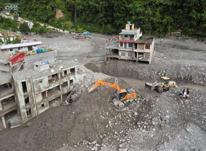
China has sent more than 680 firefighters, 113 vehicles, 47 drones and 13 rescue dogs to the Tibet side of the border in the days since the disaster. Nepal’s army has released footage of soldiers wading through mud-filled tunnels in search of survivors, and helicopters have been used to evacuate stranded villagers and tourists from areas cut off by the flooding — more than 550 tourists and close to 500 villagers were relocated within the first two days alone.
With local morgues overwhelmed by the scale of the disaster, authorities have carried out mass burials for unidentified victims while trying to match recovered remains to missing-persons reports, a process described by workers on the ground as slow and painstaking. Nepal’s Prime Minister, Balen Shah, has said the government will cover the cost of treatment for the injured, and several hospitals and colleges near the disaster zone have offered free care to flood victims as well.
The UN has set up a humanitarian coordination hub in Nuwakot to help plan and share information across the response, and estimates that around 65,000 people now need emergency access to clean water, sanitation and basic hygiene support. CARE Nepal and a number of local partner organisations are distributing shelter materials and supplies to displaced families, many of whom are now living in temporary shelters set up in schools in towns such as Bidur. Aid workers have described reaching the worst-affected communities as the single hardest part of the response, given how much of the road and communications network in Rasuwa was destroyed by the flood.
What happens next
Officials are treating the region as an ongoing hazard rather than a disaster that has already run its course, given the continuing warnings about further glacier collapses in the surrounding area. Search teams are still working through flooded hydropower tunnels and debris fields further downstream, and with roughly 3,900 people still listed as missing across Nepal and Tibet, the confirmed death toll is expected to keep climbing in the days and weeks ahead.
For Nepal, the disaster is likely to prompt a broader reassessment of how glacial hazards are monitored across its Himalayan territory, much of which remains difficult to survey in detail. With scientists warning that similar high-altitude collapses could become more frequent as the climate continues to warm, attention is now turning to how much of the country’s remaining glaciated terrain — beyond the small number of lakes already identified as high-risk — may pose a similar threat before it is properly understood.
The disaster has also renewed debate over the pace of hydropower expansion in Nepal’s mountain valleys. The country has built out dozens of hydropower projects over the past two decades to meet growing domestic demand and to sell surplus electricity to India, but this flood — like earlier glacial floods in the region — has shown how exposed that infrastructure can be when it sits directly in the path of a river fed by unstable, high-altitude ice. Engineers and disaster planners are likely to face pressure in the coming months to reassess risk mapping for existing and planned hydropower sites across similarly steep Himalayan valleys.
For more on this year’s earthquakes and severe weather, see our full World news coverage.