
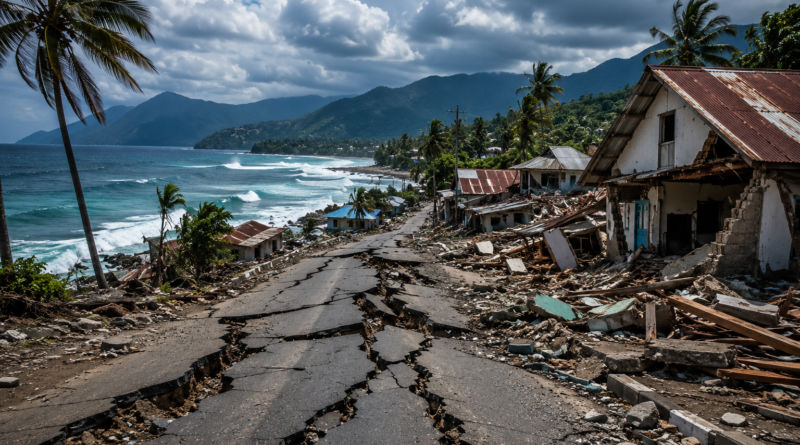
Indonesia Earthquake / Flores Tsunami Warning
Flores Indonesia earthquake 2026: A powerful magnitude 7.7 earthquake struck off the coast of Flores Island in eastern Indonesia early on Saturday, sending residents fleeing from their homes and prompting a tsunami warning that was later lifted after several hours.
The quake struck at 04:58 local time (21:58 GMT on Friday), with its epicentre located offshore around 30km (18 miles) northeast of the town of Mbay, in the Nagekeo regency of East Nusa Tenggara province. Indonesia’s Meteorology, Climatology and Geophysics Agency, known by its Indonesian acronym BMKG, said the quake was shallow, striking at a depth of just 15km — a factor that tends to intensify shaking at the surface.
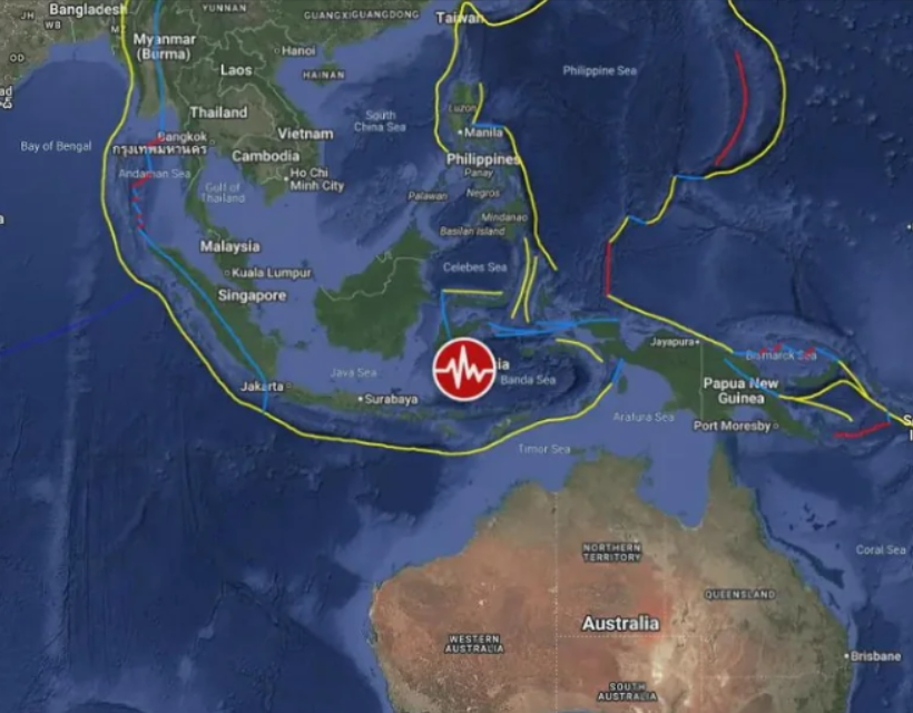
Strong tremors were felt across East Nusa Tenggara and reached as far as West Nusa Tenggara and parts of South Sulawesi, more than 500km away.
Flores Indonesia Earthquake 2026: What Happened?
Because the earthquake was shallow and occurred under the sea, BMKG issued a tsunami warning within minutes, at 05:00 local time, followed by a second bulletin nine minutes later. Coastal communities in Nagekeo, Ende, Sikka and neighbouring regencies were told to move immediately to higher ground.
Officials placed some coastal areas under their highest alert category, warning of potential waves between 0.5 and 3 metres, while other areas were told to stay away from beaches and river mouths as a precaution.
Roughly three hours after the quake, BMKG declared the tsunami threat over. Sea-level monitoring stations recorded wave heights of less than one metre in the areas checked, and officials said there was no evidence of a continuing threat. The agency has continued to urge people not to treat the lifting of the warning as a sign that all danger has passed, given the risk from aftershocks and damaged infrastructure.
Deaths and damage
Casualty figures rose sharply over the course of the day as rescue teams reached more communities, and are likely to be revised again as access improves.
Early reports from the BBC on Saturday morning referred to a single confirmed death and a small number of injuries. Within hours, Reuters and The Guardian were reporting around 20 deaths, concentrated in the port town of Maumere, where a building collapsed. The most recent figure from Indonesia’s national disaster agency, BNPB, and cited by Reuters, put the toll at 38 dead, two people seriously injured and 11 with minor injuries.
Officials cautioned that Nagekeo — the area closest to the epicentre — had not yet been fully reached by rescue teams because of landslides and downed communications, meaning the true scale of casualties and damage may not be clear for some time.
BMKG’s shaking model estimated the most intense tremors, rated VII on the Modified Mercalli Intensity (MMI) scale, in Aesesa and Mbay in Nagekeo, and in Riung in neighbouring Ngada regency. At that intensity, most people are forced out of buildings and poorly constructed structures can suffer serious damage. Nearby towns including Bajawa and Wolowae experienced intensity VI shaking, while Ende, Borong and Ruteng, further from the epicentre, recorded intensity V.
Landslides blocked sections of the Trans-Flores highway and roads leading into Nagekeo, hampering both the rescue effort and the flow of information from the worst-hit areas. Power and phone networks were disrupted in several districts, and hospitals in the region moved patients outdoors as a safety precaution while buildings were checked for structural damage.
Around 2,000 people evacuated in Nagekeo alone, according to local disaster officials, with many more moving away from coastal areas elsewhere on the island after the tsunami warning was issued. A significant aftershock, measured at magnitude 6.1, was recorded later in the day, adding to concern about already weakened buildings.
Why the region is so earthquake-prone
Indonesia sits on the Pacific “Ring of Fire”, the horseshoe-shaped belt around the Pacific Ocean where several tectonic plates meet, making it one of the most seismically active countries on Earth. Flores itself has a history of destructive earthquakes: Reuters noted that the same general area was hit by a magnitude 7.5 quake in 1992, which killed more than 2,000 people and generated a locally devastating tsunami.
Saturday’s earthquake also inevitably drew comparisons with the magnitude 9.1 earthquake off western Indonesia in December 2004, which triggered the Indian Ocean tsunami and killed around 230,000 people across the region. Scientists stress, however, that not every earthquake off Indonesia’s coast produces a major tsunami — the size, depth and type of fault movement all play a role in whether one develops.
Safety advice for those in the region
Indonesian authorities have urged residents in affected areas to rely only on official channels — BMKG, BNPB, local police and emergency services — rather than unverified reports circulating on social media. People in coastal areas have been told to stay away from beaches, river mouths and low-lying ground for as long as any tsunami warning or evacuation order remains active, and to avoid entering buildings with visible cracks, leaning walls or other structural damage, even once the initial shaking has stopped.
Standard earthquake safety guidance also applies: anyone indoors when shaking begins should take cover under sturdy furniture and protect their head and neck until it passes, rather than attempting to run outside mid-quake. Afterwards, officials advise checking for injuries, shutting off gas or electricity only if it is safe to do so, and avoiding roads blocked by debris or landslides. Residents have also been told to stay alert for aftershocks, which can bring down buildings already weakened by the initial quake — a real risk given the magnitude 6.1 aftershock recorded later on Saturday.
BMKG has directed the public to its official channels, including bmkg.go.id and its tsunami early-warning portal, inatews.bmkg.go.id, for verified updates.
What happens next
Search-and-rescue operations were continuing across Flores as of Saturday evening, with priority being given to reaching Nagekeo. Indonesia’s disaster agency is expected to issue updated casualty and damage figures as access to the region improves, and FastDailyNews will update this report as verified information becomes available.
Frequently asked questions
How strong was the Indonesia earthquake on 15 August 2026? It was measured at magnitude 7.7 by Indonesia’s BMKG, with a shallow depth of 15km, which tends to increase shaking at the surface.
Was there a tsunami? BMKG issued a tsunami warning immediately after the quake. Waves of less than one metre were recorded in monitored areas, and the warning was lifted around three hours later.
How many people died? Figures were still being confirmed at the time of writing. The most recent official count cited 38 deaths, with two people seriously injured and 11 with minor injuries, though this was expected to change as rescue teams reached more remote areas.
Where did the earthquake strike? The epicentre was offshore, about 30km northeast of Mbay in the Nagekeo regency of East Nusa Tenggara, part of the Flores island chain.